
 Gallery
Dull and Rusty
Steep Exploration and Scouting Group :: SESG Forum :: Intermediate Lines :: Combined Practices (More than one category in one run)
Page 1 of 1

Dull and Rusty
![]() by KSI THUND3RB1RD Fri Dec 16, 2016 11:58 am
by KSI THUND3RB1RD Fri Dec 16, 2016 11:58 am
Start Coordinates: 1373 N - 5022 W
Start Elevation: 15,205ft
Elevation Change: -10,840ft
Distance: 15,884ft
End Point: 725 S - 3073 W
End Elevation: 4,383ft
Route:

(1373 N - 5022 W) (843 N - 4462 W), (630 N - 4465 W), (547 N - 4397 W), (507 N - 4320 W), (72 N - 4053 W), (288 S - 3322 W), (530 S - 3151 W), (725 S - 3073 W)
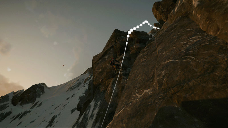
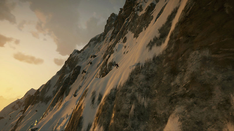
Description: This line will take you from the peak at the Aiguilles Range all the way down to lake Barberine. Prepare for one hell of a cliff jump at the beginning of this run along with steep inclines. This may be a whopping 15,205ft, but this run goes so fast that it only took me about three and a half minutes, with a few falls along the way. So be sure to watch your speed on this long distance line.
Screenshots:


~Thunder
Start Elevation: 15,205ft
Elevation Change: -10,840ft
Distance: 15,884ft
End Point: 725 S - 3073 W
End Elevation: 4,383ft
Route:
(1373 N - 5022 W) (843 N - 4462 W), (630 N - 4465 W), (547 N - 4397 W), (507 N - 4320 W), (72 N - 4053 W), (288 S - 3322 W), (530 S - 3151 W), (725 S - 3073 W)
Description: This line will take you from the peak at the Aiguilles Range all the way down to lake Barberine. Prepare for one hell of a cliff jump at the beginning of this run along with steep inclines. This may be a whopping 15,205ft, but this run goes so fast that it only took me about three and a half minutes, with a few falls along the way. So be sure to watch your speed on this long distance line.
Screenshots:
~Thunder
KSI THUND3RB1RD- Posts : 13
Join date : 2016-12-15
Steep Exploration and Scouting Group :: SESG Forum :: Intermediate Lines :: Combined Practices (More than one category in one run)
Page 1 of 1
Permissions in this forum:
You cannot reply to topics in this forum|
|
|